By allowing students to bring in their own devices for learning–rather than insisting that they learn both content and device in school–there is an important opportunity to connect with not just their personal lives, but their natural way of doing things.
Equity
While there are students who badly want technology and can’t afford even the $50, that doesn’t seem to be a strong argument against BYOD adoption, especially in light of what it costs—in time and money—to purchase, train, integrate, and maintain—state-funded, district-purchased, school-assigned devices. This is where schools, local organizations, and communities can step in.
Money and Learning
In the United States there can be a tendency to throw money at problems that are not fully understood. As a nation, America lags behind internationally, the “learning market” being one of the few markets proving evasive in lieu of continued effort, struggle, and spending.
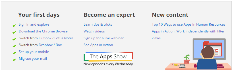
Google has their own site to help you learn how to use Google Apps, Learn Google Apps.
The site has tips on switching from other systems, tutorials, articles, tips and tricks, videos, examples of using Google Apps and much more. You can also learn by each app individually.
There’s even an weekly episode of the “Apps Show” where you can learn about new tips and features.
Koondis works in traditional large introductory lecture classrooms, blended classes and fully online courses that often are filled with students enrolled from various disciplines who are required to be there for their majors.
Described as a “social homework system,” a “discussion forum that puts students in small groups” and even a replacement for the campus learning management system, Koondis is showing great promise as a pill for student satisfaction.
The idea is that Koondis eliminates the need for teachers to read all of the posts. The program even counts posts for the instructor for grading purposes, and alertsthe faculty member to do follow-up when a student isn’t participating.
Using Tech4Learning Rubrics with Goobric, Doctopus, and the Google Classroom
“Tired of Rubistar rubrics? Want to use Goobric but don’t want to create your own rubric from scratch? In this episode, learn how to use Tech4Learning’s rubric maker to create excellent rubrics that can be used with Goobric, Doctopus, and Google classroom. Tech4Learning rubrics offer some great topics for working collaboratively, such as teamwork and cooperation. The best part is that these rubrics can easily be pasted into a Google spreadsheet for use with Andrew Stillman’s awesome Goobric extension.”
Key Trends Accelerating Technology Adoption in Higher Education 6
Long-Term Trends: Driving Ed Tech adoption in higher education for five or more years
> Advancing Cultures of Change and Innovation 8
> Increasing Cross-Institution Collaboration 10
Mid-Term Trends: Driving Ed Tech adoption in higher education for three to five years
> Growing Focus on Measuring Learning 12
> Proliferation of Open Educational Resources 14
Short-Term Trends: Driving Ed Tech adoption in higher education for the next one to two years
> Increasing Use of Blended Learning 16
> Redesigning Learning Spaces 18
Significant Challenges Impeding Technology Adoption in Higher Education 20
Solvable Challenges: Those that we understand and know how to solve
> Blending Formal and Informal Learning 22
> Improving Digital Literacy 24
Difficult Challenges: Those we understand but for which solutions are elusive
> Personalizing Learning 26
> Teaching Complex Thinking 28
Wicked Challenges: Those that are complex to even define, much less address
> Competing Models of Education 30
> Rewarding Teaching 32
Important Developments in Educational Technology for Higher Education 34
Regardless of the technology, what’s the most important lesson for students to learn?
Why do I need to use technology in my daily curriculum?
How are these tech tools enhancing what we’re doing?
What will the students do with these tools – during and after class?
Think Curriculum Enhancements, Not Technology Implementations
1) Learn How Students Are Using Technology at Home
2) Don’t Use Technology for the Sake of Using Technology
3) Focus on Just One Tech Implementation
4) Utilize the SAMR Model
TheSAMR model, developed by Dr. Ruben Puentedura, represents the stages of tech integration: Substitution, Augmentation, Modification and Redefinition. This model challenges us to assess and reflect on not only how we integrate technology into our curriculum, but also how we modify, redefine and transform our classrooms through its use.
5) Actively Seek Out Professional Development Opportunities
Younger students utilizing QR codes to add a challenging yet fun element to learning to spell.
Older students creating digital books or movies to demonstrate a deep understanding on a topic, rather than simply discussing or assessing it.
Video conferencing with other schools in your area or network to research, discuss, debate and develop potential solutions to globally significant problems.
Skyping with local leaders and guest speakers on specific topics such as coding or programming, networking and composing music.
In Short
Integrating technology into the classroom can be exhilarating, fun, and at times a little scary. That said, I’ve often found that teachers are hungry for more information, and welcome the chance to bring new ideas to the classroom.
In the end, if teachers and their administration are ready to embrace the messiness and the risks that sometimes come with technology, the reward is that your school’s curriculum – which must be strong to start – can truly be taken to the next level, and beyond. Otherwise, we’ll all be still left trying to figure out how an abacus works.
Will students be wearing their tech in virtual classrooms in five years? Wearable devices, adaptive technologies, and the Internet of Things are just some of the new tech researchers say is shaping the near future of higher education.
In 1 Year or Less: BYOD and the flipped classroom.
“Employers and higher education institutions are finding that when given the opportunity to choose their device, users are saved from the effort and time needed to get accustomed to new devices and can therefore accomplish tasks with more ease and efficiency.”
“Flipped learning is seen as especially suited for higher education because the rearranging of class time gives students in large introductory lecture courses more opportunity to engage and interact with their peers.”
In 2-3 Years: Makerspaces and wearable devices.
Makerspaces have the “benefit of engaging learners in creative, higher-order problem solving through hands-on design, construction and iteration.”
“Wearable technology is poised to see significant growth in the coming years, spurring experimentation in higher education because the demand for wearables is seen to be coming in large part from college-aged students.”
In 4-5 Years: Adaptive technologies and the Internet of Things.
“Adaptive technology is seen as a means to break free of a “one-size-fits-all” approach to education and is suited well for online and hybrid learning environments, “where student activities are conducted virtually and can be monitored by software and tracking applications.”
The Internet of Things pushes information to learners from their surroundings. “For instance, a learner exploring a city with a rich historical past can explore their environment through an architectural, political, or biological lens, depending on how the surroundings are equipped.”
From the NMC Horizon Report 2015: Higher Education Edition
Garry’s Mod(GMod) is a sandbox game like Minecraft but instead of building and exploring, students use a fun physics engine that simulates things like gravity and mass. They also use a virtual toy box of assets from Valve Software’s popular games. The tool is a step up in complexity from the elegant simplicity of Minecraft, but with Garry’s Mod,students are exposed to physics concepts while having madcap fun.
Kerbal Space Program has a robust physics engine too, but it’s more focused than Garry’s Mod. Players purchase rocket parts, put them together, and then see if they can get a ship into orbit, to one of two moons, or even to another planet. These aren’t easy tasks, so play is focused on trial and error testing, and, like Minecraft, seeking help from the community is part of a successful strategy.
Sound Shapesis a visually stunning platform puzzle game set to a rich musical soundscape. Even better: students can create and share their own levels – like interactive sheet music — using sounds and objects unlocked by playing the platform game. It’s an accessible entry point into musical composition as well as game design, and provides an experience that builds on the creativity of Minecraft while offering something wholly unique for music lovers.
For creative kids who want to get their hands dirty, check out DIY, a site where students can find things to build, instructions for how to build them, and ways to share their creations with others. All projects are aligned to 50 skills that run the gamut from outdoors to indoors, and feature various challenges to complete and cool badges to earn and display.
Computer programming is a great next step for students who love to mod Minecraft or toy around with the redstone resource (which simulates basic logic and circuitry). One solid entry-level tool is Stencyl, a game creation program focused on codeless, cross-platform game making. By snapping blocks of code together, students can create games that can be published and played on a variety of platforms including mobile phones.
Codecademy is a web-based, self-paced site that teaches actual industry-standard languages like PHP, Javascript, Python, Ruby, HTML, and CSS. While students don’t create publishable games like they would in Stencyl, their learning is purpose-driven and contextualized, e.g. JavaScript for web development or Ruby for app development. And students do get to see their code’s output directly onscreen.
Minecraft has introduced a lot of youth to games as well as the critical thinking, problem solving, and creation skills necessary for self-motivated learning. The games and sites on this list have the potential to extend that learning, providing fresh outlets for self-expression in the digital world and beyond.
Since the emergence of easily accessible dynamic online mapping tools, there has been a drastic increase in geographic interest and awareness. Whether for personal, social, professional or academic uses, people are using Geographic Information System (GIS) technology to communicate information in a map format. Whether it’s using Google Earth to study urban change, or creating Google Map Mashups to deliver library resources, more and more members of society are turning to mapping programs for their visualization needs. With so many using GIS technology in their daily lives, library staff are now more than ever assisting library clients with their mapping queries.
This course will introduce students to a variety of mapping tools and GIS technologies such Google Earth and the creation of dynamic KML files; ArcGIS Online and webmap publishing; Google Fusion Tables and geocoding; and GIS fundamentals with geospatial data creation. Students will be able to apply their GIS skills in their reference work, in digitization projects, in webpages, in library instruction, and more. Through hands-on exercises, pre-recorded demonstrations and lectures, students will receive a thorough overview of mapping resources that will enhance and expose their library’s resources.
Discover some citizen mapping projects that you are interested inOR
Contribute your local knowledge to Google Map MakerANDShare with the class online
2. Google Earth Map
Please complete the tutorial and then create a map in Google Earth with the following components:
A title
A written introduction to your project
At least five placemarks, embedded with html tags, and images, if possible.
Imported KML file(s) file format by GEarth, but other apps is using it. using notepad or MS Word, one can create KML file.
screen overlay, can be text, image, anything. legend. HTML code.
A screen overlay (i.e. a legend)
areal photography.
history.
images from the library, Google is willing to buy them. citizen mapping. scanning and uploading.
geographical and societal awareness.
Gallery: 360Cities.
google street view – historical views
Google Earth Mapping
Submit online as a KML/KMZ file
I had the opportunity to experience a gizmo that can be used to display a variety of mapping projects, including citizen mapping:Science on a Sphere. It is a sphere on which you can project static maps or animations. The one I saw, in the National Oceanic and Atmospheric Administration’s facility on Ford Island in Honolulu, displayed animations showing the 2004 Indian Ocean tsunami and the 2011 tsunami in Japan, as well as airline flight paths, ocean currents, polar ice cap change over time, and many other types of geospatial data.
The Great Backyard Bird Count actually starts today and runs through Monday, February 16th. At a minimum, it only requires 15 minutes of observation on any or all the days: http://gbbc.birdcount.org/
Happy Cow is a site well-known to many vegetarians/vegans for finding restaurants which I’ve used when travelling. Users can submit reviews and/or restaurants that they’d like profiled (although the site reserves the right to approve or not the listing).http://www.happycow.net/search.html
One of the impediments to citizen mapping is the line-of-sight cell tower limitations of mobile phones, or the wifi requirements for other mobile devices. Citizen mapping in urban and suburban environments is well-served by mobile devices, but what about natural areas, dense leaf cover, or extreme topography? Even if obtaining absolute mapping coordinates isn’t the issue, much crowdsourcing assumes an ability to connect back to a central data repository (e.g., a web database, ‘the cloud’). Equipment that can interact with GPS satellites and support data capture is typically expensive and generally requires proprietary software.
wq(https://wq.io/) is a framework that is ‘device first’ and ‘offline-enabled’. It attempts to leverage several open source technologies to build an entire mobile solution that can support citizen science data collection work, and then synchronize with a central repository once the device (and operator) return to an area served by cellular or wifi networks.
I’m stretching here, so if I get stuff wrong, please don’t yell. Still, I’ll take a pass at generally describing the framework and its related technology stack.
wq relies upon python, and a web framework called django for building offline-capable web apps that can run on iOS and Android devices. These web apps, then, rely very heavily upon javascript, particularly requirejs (http://requirejs.org/) and mustache (https://mustache.github.io/), for the templates that permit quick and (somewhat) painless web application development. Data visualization relies upon d3.js (http://d3js.org/), and geography makes heavy use of Leaflet (http://leafletjs.com/) — maybe the most pertinent layer of the stack for those of us in this course. If you’re not familiar withLeaflet.js, check it out!
Finally, wq extends several other open source technologies to enable synchronizing between a central data repository and multiple mobile devices in the hands of citizen mappers. Lastly, wq employs a set of tools to more easily build and distribute customized mapping apps that can be served from Apple’s app store, Google Play, etc.
What wq intends is to allow highly specialized citizen science/citizen mapping apps to be more easily and quickly built, based upon a solid collection of aligned F/OSS tools. Ideally, an app can spin up quickly to respond to a particular need (e.g., a pipeline spill), or a specialized audience (the run up to a public comment period for a development project), or even something like a high school field trip or higher ed service learning project.
Some examples of citizen mapping projects already built upon wq are here:
store maps online, no latitude needed.
visualize geospatial data by map
spatial analysis by mapping different layers together
showing data by map, graph or chart
e.g. how many cars cross specific point
crowdsourcing: spotting butterflies, using fusion tables to map the spices and sightings http://www.theguardian.com/news/datablog/2011/mar/31/deprivation-map-indices-multiple
students: journalism, history, geography.
Georeferencing (geocoding – data, geo referencing – image)
historical air maps or photos are much more useful when they are georeferenced.
Photos from different year is difficult to lay over one another without referencing. the only reference might be the river. usually reference the four corners, but sometimes river. Using GIS program to determine the longitute/latitude for each corner. sometimes only farmland and it is impossible

.png)


